Investigating frozen ground dynamics by using GNSS interferometric reflectometry (GNSS-IR)
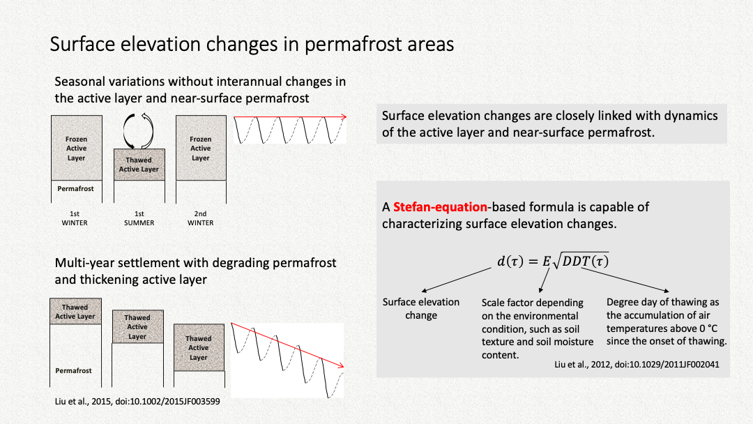
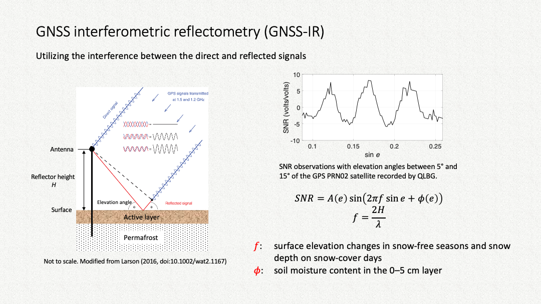
Permafrost refers to the ground whose temperature remains at or below 0 °C for at least two consecutive years. On top of permafrost is the active layer undergoing seasonal freezing/thawing. The changes in the active layer and permafrost affect the hydrological, geomorphological, and ecological processes. Due to active layer freezing/thawing, the ground surface in a permafrost area is subject to uplift/subsidence. Surface elevation changes are closely linked to the thermal and hydrological changes in the frozen ground. GNSS-IR can measure surface elevation changes. It can also estimate near-surface soil moisture content and snow depth, which also affect frozen ground dynamics. The following slides, presented in the IGARSS 2021, shows the concept of using GNSS-IR to study permafrost and summarizes my findings.